Wednesday, May 23, 2012

Regulations of this Wilderness Area


The 
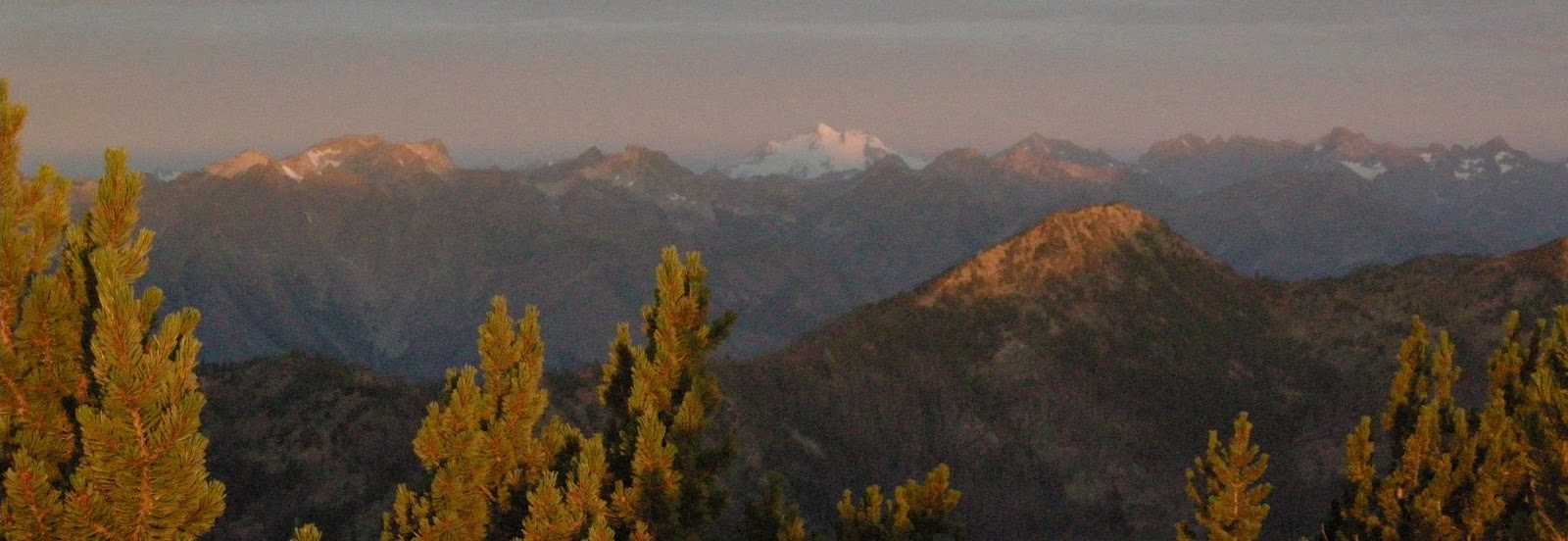
Lake Chelan-Sawtooth Wilderness is part of the 110 million acre National Wilderness Preservation System. Which provides clean air, water, and habitat critical for rare and endangered plants and animals. In wilderness, you can enjoy challenging recreational activities like hiking, backpacking, climbing, kayaking, canoeing, rafting, horse packing, bird watching, stargazing, and extraordinary opportunities for solitude. Humans play a very important role in helping to "secure for the American people of present and future generations the benefits of an enduring resource of wilderness" as called for by the Congress of the United States through the Wilderness Act of 1964. Ther are certain requirments and regulations people need to follow when visiting any Wilderness area.


Prohibitions:

The following are prohibitions for Chelan-Sawooth wilderness area. These general prohibitions have been implemented for all national forest wildernesses in order to implement the provisions of the Wilderness Act of 1964. The Wilderness Act requires management of human-caused impacts and protection of the area's wilderness character to insure that it is "unimpaired for the future use and enjoyment as wilderness."

  • Motorized equipment and equipment used for mechanical transport is generally prohibited on all federal lands designated as wilderness. This includes the use of motor vehicles, motorboats, motorized equipment, bicycles, hang gliders, wagons, carts, portage wheels, and the landing of aircraft including helicopters, unless provided for in specific legislation.
Permits:
  • A wilderness permit system has been put into placement for this wilderness. This involves a mandatory permit for access to the wilderness, which does not limit use. Wilderness permit systems are implemented to collect information on use levels and patterns and as an education and information tool.

People interested in visiting theLake Chelan-Sawtooth Wilderness should contact the national forest office for more information about this permit system, which may vary by location or time of the year.
Fees:
  • The following user fee system has been implemented for the Lake Chelan-Sawtooth wilderness: TRAILHEAD PARKING. Fees are most often used to offset the operating costs of a permit system or to help fund management activities such as trail maintenance.
* Federal Regulation's
  • 12 & 18 * Party Size*
    Groups traveling in the wilderness must have no more then 12 people and no more than 18 head of pack and saddle stock. 36 CFR 261.58(f)
  • Caching and Geocaching*
    Sorry, not allowed. Camps or any other supplies, or GEOCACHES can’t be left unattended more than 48 hours. 36 CFR 261.57(f)
  • Wheels*
    Travel in wilderness areas is by foot, horseback, or self-propelled boat. Bicycles, wagons, carts or any other wheeled vehicles, pedaled, pushed or pulled, are not allowed. 36 CFR 261.57 (h)
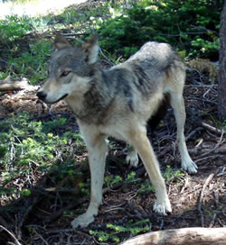
  • Dogs*
    are allowed in the wilderness but must remain under control at all times and are not permitted to menace or annoy other visitors, stock, or wildlife.
  • Motorized Equipment*
    No motorized equipment including chainsaws and motorbikes. 36 CFR 261.16(a)
  • Shortcutting Switchbacks*
    on trails is prohibited. 36 CFR 261.55 (e)
  • Cutting of trees or branches*
    for any purpose is not permitted. Use only dead, down wood for fires.
  • Grazing or Tying Stock*
    within 200 feet of the shoreline of any lake is not permitted. Don’t ride right to lakeshores – tie up & walk the last 200’. If animals paw constantly while tied, hobble them. Stock may not be tied directly to trees overnight in the Pasayten and Lake Chelan-Sawtooth Wilderness. If a high line is used, the point of hitch or tie must be at least 8 feet from any tree. 36 CFR 261.57 (a,e) 36 CFR 261.58 (aa)
  • Only processed grains*
    May be transported into the wilderness. Hay or unprocessed grain may serve as a seed source for noxious weeds or other non-native plants and is not allowed. 36 CFR 261.58 (t)
  • Littering*
    Whether it be candy bar wrappers or toilet paper, littering is strictly not allowed. Pack out all litter. 36 CFR 261.11(b)
  • Permits*
    Self issuing permits are required for the Pasayten. They are available at trailheads, headquarters, and the visitor center. 36 CFR 261.57


Methow Valley

The Methow Valley offers some of the most unique and beautiful scenery in the North Cascades. From Alpine Forest to desert surroundings. It is not unusual to see eagles, deer, Blue Heron, beaver, rattle snakes,  and many other wildlife species.


There are many Recreational opportunities just out of the Methow Valley that lays in the Center of the Lake Chelan Sawtooth Wilderness; Rafting, hiking, hors packing, camping, fishing, snowmobiling, snoboarding/skiing and more!


River Rafting the Methow River
The heart of the Methow Valley is known as a small town called Twisp. In the foothills of the North Cascades and the Sawtooth Mountains, Twisp is surrounded by National Forest, state lands and wilderness areas.

During the summer in the Methow Valley: There are numerous campgrounds along the Twisp River, at Black Pine Lake and other areas. From Twisp there are many opportunities for hiking wheather it by day hikes or multi-day backpacking trips throughought the Okanogon National Forrest including the Chelan-Sawtooth Wilderness area. From the end of the Twisp river to the north you can find good Rock Climbing. Also, Mountain Bikers are welcome in the Area and on the Twisp River trail in the Okanagon National Forrest. http://twispinfo.com/ 


Rock Climbing Area in Methow Valley


During the winter in the Methow Valley: There is an ubundance of ungroomed trails trails as well as easy access to to Backcountry skiing in National forrest and Chelan-Sawtooth Wilderness Aea.


Trails of the wilderness


Crater Lake (3500 ft)


The diverse mixture of dense forest, lush meadows, alpine slopes, geology and high country motivates visitors to climb from lowland trailheads through the forest. It draws backpackers, horse packers, fisherman, and hunters. Trails tend to be steady climbs into high basins and glacial cirques with lakes. The south facing portion of the range has more open, rolling high country that falls off very steeply into the Lake Chelan valley. There are over 63 high alpine lakes within the wilderness, many too small to even be named.

This wilderness is a great alternative for easy hiking and scrambling when the weather on the west side is rainy and cold. Trailheads in the Lake Chelan-Sawtooth Wilderness, unless accessed by the Lake, are often over 3,000ft.  All trailheads on the south side of the wilderness are right off of Lake Chelan. Access to these trails is limited to a ferry or personal boat rides across the length of the lake up to Stehekin, a small no road town.
The Stehekin Valley is the gateway to the North Cascades National Park and offers world class scenery, hiking, horseback riding, river rafting, biking, kayaking, boating, bakery, restaurants, shuttle bus to High Bridge. Visit the historic Buckner Orchard, the one room school, and Rainbow Falls (318ft).
Stehekin Landing and Village
Stehiekins Amazing Bakery


Access to North and East trails of the wilderness go through miles of national forest land before entering the actual wilderness. The good thing about trails on the Twisp River side is that they don’t get the numbers of people traffic as of places with the easier access. Trails entering from the west side of the wilderness first crosses North Cascades National Park or Lake Chelan National Recreation Area. The drawback to the trail heads not beginning in the Wilderness itself is they are often used often by motorized vehicles, creating drenched and dustier trails. However, once you reach the actual wilderness motorized vehicles are prohibited.


Hike the east side of the Cascade Range, and you’ll discover jagged skyline views that equal those on the more crowded west side—and that aren’t obscured by a near-daily dose of cold, pounding rain. This four-day, 32-mile traverse from the tiny village of Stehekin to Prince Creek Campground (both on Lake Chelan) begins with a relentless, 5,700-foot climb on the Purple Creek Trail to Purple Pass. Camp at Lake Juanita after 7.3 hard-earned miles. For the next two days, follow the Chelan Summit Trail below the craggy Sawtooth Range; you’ll likely see more black bears than people (our Northwest Editor notched daily bruin sightings). The rugged trail pays off with views of Glacier Peak and the North Cascades across 50-mile-long and two-mile-wide Lake Chelan, which sits at the bottom of a trench 2,000 feet deeper than the Grand Canyon. Bridges— including a critical one across Prince Creek, which cannot be forded—receive infrequent maintenance; call the Chelan Ranger District before heading out. Local knowledge Best campsite: the stream-cut wildflower meadows of Horseshoe Basin at mile 16.5


Horse Shoe Basin from Oval Pass


Tuesday, May 22, 2012

Long, Lean and Beautiful


Lake Chelan is 55 miles long, 1,486ft deep making it the third deepest lake in the country and the 25th in the world. The average width of the lake is 1 mile across. Long, lean and beautiful best describes Lake Chelan. With some of the cleanest glacial waters I have ever swam in, with deep colors of greens and blues with very good visibility.


The Lake Chelan Sawtooth Wilderness Area contains 151,435 acres all in the state of Washington located within the Okanogan and Wenatchee National forest. It became a part of the 109 million acre National Wilderness Preservation System in 1984.


The Lake Chelan-Sawtooth Wilderness is located on the east side of Lake Chelan and runs in a northwest-southeast direction over about 25 miles. The crest of the divide is generally known as the Sawtooths. However, they dont really look like Sawteeth with the exception of a few Rock Glaciers and Steep North Walls. Martin Peak, Mt. Bigelow, and Star Peak all are good examples having steep north walls.

The North Side of Star Peak ( 8690 ft)

From the Northeastern shore of Lake Chelan, the Wilderness rises rapidly to the crest of the Sawtooth range, which cuts diagonally through the Lake Chelan area. Northeast of the crest of the range, terrain drops down in to the Methow Valley of the Twisp River only to climb again on the other side.
Twisp River
 
Wolf creek and other drainages have created deep ravines throughout the wilderness area; making elevations within the wilderness vary from 1,100ft to 9,000. The highest point in the Wilderness is Gardner Mountain (8,897 ft) on the northern boundary. The highest point in the area most associate as the Wilderness is Oval Peak (8,795 ft).


Gardner Mountain (8,897ft)


Oval Peak (8,795 ft)


One cool thing about this area is the Reoccuring sitings of Gray Wolves.


The gray wolf is an endangered species throughout Washington under state law and is endangered under federal law in the western two-thirds of the state. Wolves were once common throughout most of Washington, but declined rapidly from being aggressively killed during the expansion of ranching and farming between 1850 and 1900.


Pups of the Lookout Pack
Multiple wolf reports from Okanogan County in 2008 led to confirmation of the first fully documented breeding by a wolf pack in Washington since the 1930s. The wolves became known as the Lookout Pack, consisting of at least four adults and six pups in 2008.  A male (WA-144M) and female (WA-142F) were captured and radio-collared in July 2008 and other pack members, including the 6 pups, were caught on remote cameras in the summer of 2008. DNA samples connect the pack with wolves from British Columbia and Alberta, and biologists said they have naturally immigrated, dispersing from larger wolf populations in Canada. Based on telemetry monitoring between 2008 and 2010, the Lookout Pack used an area of about 350 square miles, with the primary prey being deer.

 As of 2011, Recent activity in the Lookout territory indicates there are still at least two wolves in the pack. In September, 2011 a hunter documented at least two and possibly three animals in the far western portion of the traditional Lookout territory. 


The draft Washington Gray Wolf Conservation and Management Plan plus facts and information on the wolf and how to report sightings may be viewed at www.wdfw.wa.gov/wlm/diversity/soc/gray_wolf/.