 |
| Crater Lake (3500 ft) |
The
diverse mixture of dense forest, lush meadows, alpine slopes, geology and high
country motivates visitors to climb from lowland trailheads through the forest.
It draws backpackers, horse packers, fisherman, and hunters. Trails tend to be
steady climbs into high basins and glacial cirques with lakes. The south facing
portion of the range has more open, rolling high country that falls off very
steeply into the Lake Chelan valley. There are over 63 high alpine lakes within
the wilderness, many too small to even be named.
This
wilderness is a great alternative for easy hiking and scrambling when the
weather on the west side is rainy and cold. Trailheads
in the Lake Chelan-Sawtooth Wilderness, unless accessed by the Lake, are often
over 3,000ft. All trailheads on the
south side of the wilderness are right off of Lake Chelan. Access to these
trails is limited to a ferry or personal boat rides across the length of the
lake up to Stehekin, a small no road town.
 |
| Stehekin Landing and Village |
 |
| Stehiekins Amazing Bakery |
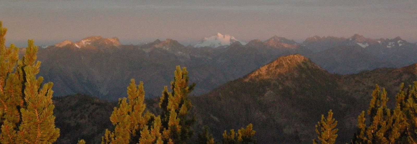
Hike
the east side of the Cascade Range, and you’ll discover jagged skyline views
that equal those on the more crowded west side—and that aren’t obscured by a
near-daily dose of cold, pounding rain. This four-day, 32-mile traverse from
the tiny village of Stehekin to Prince Creek Campground (both on Lake Chelan)
begins with a relentless, 5,700-foot climb on the Purple Creek Trail to Purple
Pass. Camp at Lake Juanita after 7.3 hard-earned miles. For the next two days,
follow the Chelan Summit Trail below the craggy Sawtooth Range; you’ll likely
see more black bears than people (our Northwest Editor notched daily bruin
sightings). The rugged trail pays off with views of Glacier Peak and the North
Cascades across 50-mile-long and two-mile-wide Lake Chelan, which sits at the
bottom of a trench 2,000 feet deeper than the Grand Canyon. Bridges— including
a critical one across Prince Creek, which cannot be forded—receive infrequent
maintenance; call the Chelan Ranger District before heading out. Local
knowledge Best campsite: the stream-cut wildflower meadows of Horseshoe Basin
at mile 16.5
 |
Horse Shoe Basin from Oval Pass |

No comments:
Post a Comment